Saturday, June 4, 2011

Seligman --> Santa Monica: The End of the Road

Las Vegas: Detour to Sin City
Because neither of us had been to Las Vegas, we took one more overnight detour on our way to California. By the time we reached the Strip, our beloved Elvis was groaning in pain every time we touched the breaks - so we traded him for Marilyn and believe he ended up in the right town anyway.

So sad to leave Elvis behind.
Marilyn has a sunroof!
Coming into Vegas.
Perhaps due to a glitch in the Priceline system, we got an outrageous deal on a room at Vdara - a new hotel in the heart of the Strip known for luxurious rooms and a sunny 'death-ray' created by the angle of the building's glass exterior. Around noon every day, the sun's reflection off the Vdara concentrates on a small portion of the pool deck and is strong enough to burn hair and melt plastic. We stayed inside. 

The beautiful Vdara (home of the death ray!)

View of the Strip and Bellagio Fountain from our room by day.
View of the Strip and the Bellagio Fountain from our room by night.
We've never seen the Lion King on Broadway despite our frequent trips to New York, so we were thrilled to book tickets for the Las Vegas version at Mandalay Bay. While the actors retained much of their human form, we were shocked at how well they integrated animal-like movement and behavior. After the show, we quickly lost the $40 we agreed to spend on the Bellagio's slot machines and spent the rest of the evening and early morning exploring the Strip. 

Santa Monica Pier: The End of the Road
The last leg from Las Vegas to Santa Monica was the longest stretch of our journey. After reconnecting with the Route in Barstow, CA, we passed through a number of small cities on our way through the sprawling metropolis surrounding Los Angeles.  Compared with other sections of Route 66, many of the businesses and communities in California are thriving.  In some towns along the road in Missouri or Oklahoma, populations range from 200-800 people.  Coming into LA, places like Rancho Cuccamonga and Victorville have north of 100,000 residents.  Even in these places, where the Route is not the only road through town, historic signs are everywhere.

Rt 66 sign in Victorville, CA.
The other Wigwam Motel in Rialto, CA.
As expected, we encountered more traffic in the last 30 miles into Los Angeles than we did during our entire trip. For a couple of weary travelers, our only solace from the congestion was the rapidly cooling temperature (88 in the Mojave desert, 65 in Santa Monica) and the scent of the ocean in the air. 

Coming into downtown LA.
Through downtown LA, the route turns into Sunset and then Santa Monica Boulevards, passing through West Hollywood and Beverly Hills before entering Santa Monica. We anxiously counted down the final miles as soaring palm trees lined our approach to the coast. 
iPhone GPS showing the last 2.8 miles of our 2,400+ mile adventure.
The home stretch!
As the Pacific came into view, we turned onto Ocean Avenue, arriving at our beachfront hotel. Splurging a bit for our last stay, we checked into the Georgian, an art deco masterpiece that opened in the 30's as a retreat for Hollywood elite.
 
The Georgian
We quickly threw our bags in the room, and made our way to the Santa Monica Pier, the official end of the Route.  With a cool breeze blowing in off the coast, we leaned over the railing and watched the sun start to set over the Pier.  Two weeks ago, we stood at the intersection of Lakeshore Drive and Jackson Boulevard overlooking Lake Michigan, surrounded by the Chicago skyline. Over 2,500 miles later, we walked from the corner of Santa Monica Boulevard and Ocean Avenue onto the pier, marking the end of Route 66 and our journey across our country.
 

We spent the rest of our evening with beloved friends (Zoe, Shiggs, and Jake :) at a local restaurant in Venice Beach and, before we depart LA tonight, are taking some time at the Pier and under the sun.

 -------------------------------------------------------------------------
Don't leave us yet! While we've reached the end of the road, this is not our last post. We'll do a "best of the route," including some creative amalgamation of the things we've learned, and an update to our "Resources and Links" page.

Thursday, June 2, 2011

Northern AZ: Grand Canyon & The Birthplace of Route 66 Revival

Though not officially on the Route, the Grand Canyon is only a two hour detour off the Flagstaff to Seligman leg. To get there, we drove through endless evergreen forests – an unexpected landscape given our impression of the Canyon as surrounded by desert. We made our way through the parking lot and visitor’s center, packed with more international tourists than Americans, without seeing any glimpse of the giant hole.

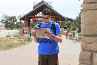
Joe, making sure we don't fall off the edge.

Following a group of Japanese teenagers, we walked up a paved incline to the first overlook and saw this:


“Can you imagine being that first person,” said the woman behind us, “who was just walking along one day and saw this?” Despite our best effort, it’s impossible to capture the Grand Canyon in a picture – which puts artificial boundaries on a vast expanse of complex geology and beauty. 


This is as close as we could get without fainting.


Seligman: Birthplace of Historic Route 66
Two hours from the Grand Canyon and four from Vegas (our next stop), we stayed overnight in Seligman, Arizona, home of the first Route 66 preservation association and credited with the rebirth of the highway. Seligman is also home to Angel Delgadillo, a barber born and raised in town and witness to its “near death” when bypassed by I-40. Believing in the “power of memory and myth,” Delgadillo is one of the most influential founders of the highway preservation effort both in Arizona and nationally and is now known as “the Angel of Route 66.”


Pictures of Angel in his old barber shop.


Lindsey, hoping for a haircut.

We checked into our Vegas-inspired room at the historic Canyon Lodge and met Reinhardt, a native German who ended up in Seligman after moving around the west coast. We told Reinhardt about Joe’s family in Koln (hi, Urbachs!) and that we traveled there two years ago to see them. “Oh, that’s nearby Mainz,” he said, “where I grew up.” Sitting on the motel’s balcony a few minutes later, we noticed the German flag waving among U.S. and Route 66 ones.

Street view of the Canyon Lodge.

We ordered burgers (cheese and veggie) and a local stout from famous Lilo’s Westside Café, which also flies both an American and German flag - representing the food, the nationality of the owners, and a good portion of the tourists who stop in Seligman. Our tiny waitress was a one-woman-show, running the souvenir shop, the dining room, and slap-stick entertainment for guests. When asked why she moved to Seligman from California, she said, “My kid’s at NAU, and there’s better hunting here.”


Before heading to Vegas in the morning, we stopped in a half dozen souvenir and “curios” shops that now make up the majority of Seligman’s business district – which intentionally time warps tourists back to the 1950s by blaring early rock music out onto main street, parking classic cars in front of store fronts, and dressing mannequins to resemble James Dean and Marilyn Monroe. On an early Thursday morning at the beginning of tourist season, the street was lined with tour buses and motorcycles.

Part of Seligman's business district.

Joe making some friends.


Lindsey with Lyn, owner of one of the curio shops / cafes.


Wednesday, June 1, 2011

Flagstaff: A Stunning Mountain Town of Friendly, "Earthy" People

In northern Arizona, the Route winds through forests of tall evergreens and brings travelers into Flagstaff against the backdrop of the San Francisco Peaks mountain range.  The town developed first as a railway hub between Albuquerque and the west coast in the late 1800s, and then continued to grow through the development of a lucrative timber industry.


After WWII, the Santa Fe Railroad carried returning soldiers – including Joe’s grandfather, Paul – through Flagstaff as they traveled from San Francisco to Fort Dix, NJ to be discharged. Paul was discharged on June 7, 1946, and still remembers Flagstaff fondly, sharing with his grandchildren that the locals offered him and his fellow soldiers lemonade and cookies.

Flagstaff Train Station


Flagstaff High School

Arriving in the early afternoon, we entered downtown as it was abuzz with street musicians, window shoppers, and locals enjoying a beer at sidewalk cafés (still trying to figure out what they do for a living and how to adopt that career). We checked into Hotel Weatherford, opened first in 1900 by John Weatherford "back when Arizona was a territory and vigilantes rules the dirt streets."  When we booked the reservation, we received a gentle warning that the Weatherford is an old hotel with a noisy bar and nearby train station and we should reconsider our request if earplugs wouldn't be enough to overcome that. But, of course, they were. The Weatherford is also famous for its annual New Year’s Eve Pinecone Drop (which replaces the traditional silver ball with a giant, bedazzled pinecone and is an upgrade from the hotel’s former “decorated trashcan drop”).

Weatherford at night.

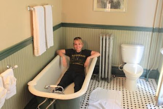
2nd Clawfoot Bathtub of the Trip
We each enjoyed a local beer on the Weatherford’s patio as we worked on our last blog post and watched helplessly as an unserious street musician, assisted by a few good Samaritans, chased his money down the road after he accidently kicked over the donation can. We headed to a local brewery for dinner and enjoyed wood-fired pizzas among a crowd of local couples, one earnestly juggling both a toddler and infant. When asked about Flagstaff, Dylan (our waiter from southern California) described locals as “earthy, liberal, and good people who say hello to each other. Not like in the Valley.”
Beaver Street Brewery

Flagstaff downtown at night.

We spent some time wandering downtown Flagstaff, peering in the windows of many local outdoor and art shops and snapping a few photos of local graffiti. We stopped in the Weatherford’s bar to catch the tail-end of an open-mic night, during which a silver haired man with one bad eye wailed on an electric guitar and a group called the “Heart Vision Tribe” dedicated their performance of “Milk Bones and Coffee” to rescue dogs.

Mural reads "When you see only the dark, know the light will soon return."

In the morning, we grabbed a quick breakfast at the local diner before heading to the Flagstaff Visitor’s Center (housed in the old train station building). Of course, a Lindsey/Joe trip across the country would not be complete without running across at least one injured animal, so we were due. After forming a rescue alliance with the Visitor’s Center staff, Joe successfully removed an injured pigeon (George) from the train tracks with a cardboard box and a lot of patience with me. A local bird rescuer finally came and took George – who turned out to be “the bird equivalent of a teenager” - away with her, and we headed to the Grand Canyon.


Poor George jumped out of the box, drank from a puddle, then hid in this corner.

Beautiful place.

Tuesday, May 31, 2011

Holbrook --> Flagstaff: Jackrabbits, Winslow, and Space Aliens

Flagstaff post to come tomorrow. Apologies for any errors in this post - Joe insisted on editing it aloud in an Elmer Fudd voice. Might be a hilarious adventure to read it to yourself in similar fashion.

Jackrabbit Trading Post: Lindsey Tries to Adopt a Life Size, Plastic Bunny
We began our morning at the Jackrabbit Trading Post, which - like Henry's Rabbit Ranch - advertises itself miles in advance with yellow "Here It Is" signs. With an embarrassing amount of excitement, I scampered from Elvis to climb atop the giant, plastic Jackrabbit outside the store with no success in convincing Joe to do the same.


Inside the Trading Post, we met Cindy Jaquez (3rd generation owner) and her daughter - an endearing teenager just learning how to greet customers and use the cash register. After purchasing a few more Route 66 coozies and magnets, Cindy handed us two passport booklets. "If you're traveling west," she said, "you can get this stamped at different stops along the way and turn it in for a prize." We left, in equal glee as we arrived, wondering what such a prize could be.


Winslow, AZ: "Another Tough Town that Refuses to Die"
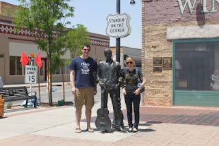
We stopped next on a corner in Winslow, Arizona (and had to wait all day to write that sentence). Lost in a town with less than three thousand households, we found our way to the corner by following other erratic, out-of-state drivers and the faint sounds of Eagles' music. Surrounded by neglected front yards and businesses barely surviving, the "corner in Winslow, Arizona" is out of place with its spotless memorial and high-end souvenir shop. But no less than a dozen tourists were ambling about, taking photos of one another and singing the famous lyric over and over again. Multiply a dozen tourists for every hour of every day in the year, and that song may have single-handedly saved Winslow.


Eagles' 79 tour to Pittsburgh. Fitting.
 Winslow's heyday is best immortalized in the newly restored La Posada Hotel, which famed architect Mary Jane Colter designed and Fred Harvey financed in 1929 as "the finest resting place in the Southwest." In the 1960s, Winslow was the second largest city in northern Arizona and many folks expected it to become another boom town for the West. But in the '70s, Interstate 40 bypassed Winslow - the effects of which persist today.

The Eagles released their first album in 1972, including Take It Easy, and unknowingly threw a life-line to forsaken Winslow. In 1994, a year after Travis Tritt remade the song and shot it to the top of the charts, the Standin' on a Corner Foundation - an amalgamation of local Route 66, La Posada, and "corner" enthusiasts - embarked on an ambitious plan to save the town. It rescued La Posada the same year and the hotel is thriving with business today.

La Posada Hotel.

La Posada's beautiful gardens.
Driving into Winslow, we also saw something unexpected - a 9-11 Remembrance Garden honoring those killed. It includes two beams from Ground Zero, which the town worked hard to secure and transport before the first anniversary of the tragedy.


Meteor City: The Home of Eduardo the Space Alien
About halfway through our journey, we realized that I'm really on this trip for the people (hence, our blog title). Joe is equally passionate about places - and rocks. Old ones. And holes in the ground. Big ones. So, we had to stop at the giant meteor crater in the middle of nowhere, Arizona and I'm ghost writing the remainder of this post out of love for him.


Also known as the Barringer Crater, this (500+ foot deep and 2 1/2 mile round) crater was formed over 10,000 years ago when a meteor (approximately 150 feet across) hurtled to the earth's surface. After a short video, informing us about how meteors will probably kill the human race in the near-distant future, we walked to the crater as guided by the resident "hole-in-the-ground" expert and self-described space alien, Eduardo (who told us he was traded by the aliens for Jeff Bridges in Starman).

Eduardo - Best Tour Guide Ever

Big piece of the rock that Eduardo told us to rub for good luck.

Joe, lookin' for John Glenn.
Seated on wooden benches overlooking the hole, Eduardo asked where the audience came from. "Fred's Tavern?" he asked Joe, looking at his t-shirt. "I wanna go there." For the next 15 minutes, Eduardo the Space Alien described the crater, drawing upon his experience as a drama major at UTEP and writer in Los Angeles. "When Barringer saw the canyon," Eduardo said, turning his back to us to peer over the crater. "He said "AYE-CHIHUAHUA." The audience laughed and he continued, "Okay, maybe not. But he was bilingual."